
05Bay entranceBetween Luštica and Prevlaka
Mamula. A fortress in the sea.
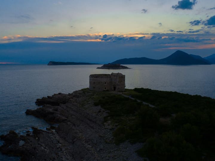
A round fortress on a tiny island in the gateway to the Bay of Kotor, built in 1853 to guard the way in. On the way out to the open sea, you sail right past its walls.
The gate to the bay
Three forts, one gate.
The Bay of Kotor has only one way in from the open sea — and the little island of Mamula sits right in that gateway. In 1853 the Austrian general Lazar Mamula had a round fortress built here, and the island still carries his name.
At his suggestion, two more forts went up at the same time on the headlands either side: Arza on Luštica and Oštro on Prevlaka. Together the three were meant to close the entrance to enemy ships. Sailors’ charts still call the island Lastavica — the swallow.
Its darkest years came with the Second World War. In 1942 and 1943 the Italian occupation turned the fortress into a concentration camp; more than two thousand people passed through it, most of them civilians from Boka, Herzegovina and Dalmatia. Many never came home. Every September, families of former prisoners gather on the island to remember them.
- Mamula, the round fortress (1853)
- Fort Arza, on the tip of Luštica
- Fort Oštro, at the tip of Prevlaka
- The only way into the bay
- Our course today, on to the Blue Cave
Coastline © OpenStreetMap contributors
- the round fortress is built
- 1853
- across — the whole island
- ≈ 200m
- forts guarding the way into the bay
- 3
- of water between Mamula and Luštica
- ≈ 1km
Getting there
From Tivat, to the gate of the bay.
Every trip starts on the Tivat promenade. The course crosses the bay to the Kumbor Strait, follows the Luštica shore past Rose and comes out at the mouth of the bay — where Mamula keeps watch over the open sea.
- TivatDeparture from the promenade 0 km
- Kumbor StraitInto the outer bay 8 km
- Submarine tunnelThe boat slips into an old navy tunnel 9 km
- MamulaIsland fortress from 1853 ≈ 17 km
Map data © OpenStreetMap contributors
Tours that go there
-
3 hprivate
BookOpen sea & swimming
Blue Cave Tour
Into an old submarine tunnel, past the island fortress of Mamula and out to the Blue Cave, where the water glows electric blue — swim right in — and on to two more sea caves nearby.
-
4 hprivate
BookBay & open sea
Boka Bay + Blue Cave
The bay’s greatest hits in one unhurried loop: the submarine tunnel and Mamula, a swim in the Blue Cave, then back into the bay to Our Lady of the Rocks and Perast.
Prefer your own route? Add Mamula to a Custom Tour of five to eight hours.
On the spot
Circle the island, then out to sea.
-
Sail round the fortress
From the water you see it all — the round walls rising straight out of the rock, much closer than from any shore.
-
Spot its two sister forts
Look east to Cape Arza on Luštica and west to the tip of Prevlaka: the forts built with Mamula still face each other across the entrance.
-
Stop at Žanjice
A long pebble beach a few minutes away — a swim stop on the way back, or a lazy hour ashore on a Custom Tour.
-
Carry on to the Blue Cave
Mamula is the last landmark before the open sea. Round Cape Arza, and the Blue Cave is only a few minutes further along the Luštica cliffs.
- Best light
- Morning and late-afternoon light suit the island best: the low sun warms the stone against the deep blue of the open sea.
- Sea & weather
- Mamula sits where the bay meets the open sea, so the water here can be livelier than inside the bay. On a windy day Boris may keep a little further off — or save the island for a calmer morning.
- Going ashore
- The island is private today — the restored fortress is now a hotel — so on our tours you see Mamula from the water, close up and from every side.
- Bring along
- A camera with a little zoom for the walls — and swimwear: Žanjice and the Blue Cave are just around the corner.
Keep exploring
Near the gate, worth the detour.
-
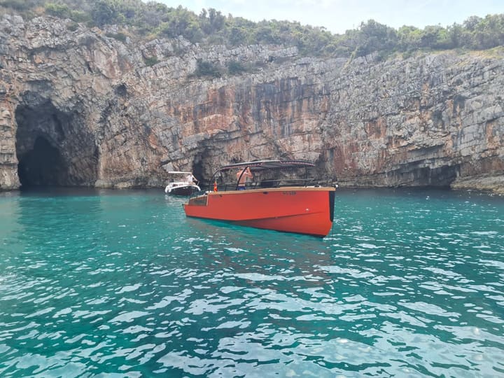
Blue Cave
Swim in the glowing blue water
A sea cave on the Luštica peninsula where sunlight comes up through the water and turns it electric blue. Swim right inside — when the sea is calm enough.
≈ 22 km from Tivat
-
Luštica
Hidden coves and clear water
A green peninsula of olive groves and quiet coves between the bay and the open sea. On a Custom Tour, Boris will find you a cove for a long swim.
≈ 18 km from Tivat
-
Herceg Novi
Old town and fortresses
The town at the entrance to the bay, founded in 1382 by the Bosnian king Tvrtko I — fortresses, stone stairways and an old town that faces the sea.
≈ 14 km from Tivat

Sail out to the gate of the bay. The open sea starts here.
Open daily 09:00 – 23:00